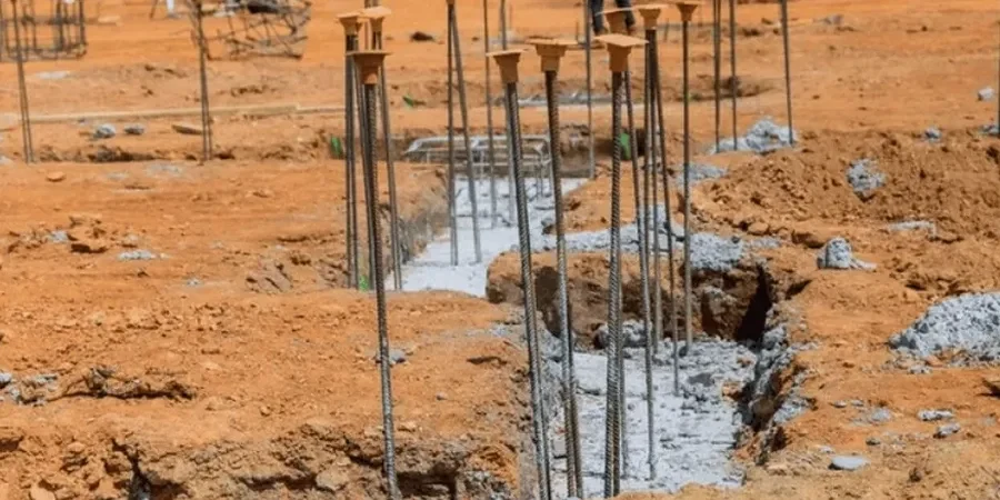
The St. Louis subsurface doesn't give you much margin for error. Between the Mississippian limestone karst features and the saturated floodplain silts along the Mississippi River front, designing a pile foundation here means reading the rock carefully. We've pulled cores from downtown sites where solid limestone sits at 15 feet, and a half-mile west the same formation is riddled with voids and mud seams down to 40 feet. The city's bedrock topography is wildly irregular—pinnacles, cutters, and buried sinkholes are common across the metro area. That's why every pile foundation design in St. Louis should start with a thorough geotechnical investigation. We rely on SPT drilling to map the overburden and identify refusal depth, and when organics or soft clay lenses show up in the alluvial plain, we correlate with CPT testing to get continuous tip resistance and sleeve friction profiles before sizing the piles.
In St. Louis, pile refusal on limestone doesn't guarantee bearing—you need to prove the rock socket extends past the weathered zone and into competent, uncontaminated carbonate.
Process and scope
Local ground factors
A lot of foundation problems in St. Louis trace back to assuming the top of rock is uniform. We've observed projects where piles terminated on a thin limestone ledge overlying a solution cavity, and the resulting differential settlement cracked the superstructure within two years. The karst topography doesn't announce itself on a grading plan—you need continuous rock coring and possibly downhole geophysics to catch voids before mobilization. Another common oversight: ignoring negative skin friction from the compressible alluvial clays that blanket the Missouri and Meramec River valleys. When these clays consolidate under new fill, they drag down on the pile shaft, eating into your structural capacity. A design that looks fine on paper at 100 tons can be fully consumed by downdrag if the site stratigraphy isn't properly characterized. The local building departments in St. Louis City and County now require specific karst investigation protocols for Category II and III structures, and for good reason.
Watch the video
Reference standards
ASTM D1586 - Standard Test Method for Standard Penetration Test (SPT) and Split-Barrel Sampling of Soils, ASTM D2487 - Standard Practice for Classification of Soils for Engineering Purposes (Unified Soil Classification System), ASTM D6032 - Standard Test Method for Determining Rock Quality Designation (RQD) of Rock Core, ASCE 7-22 - Minimum Design Loads and Associated Criteria for Buildings and Other Structures, IBC 2021 - International Building Code, Chapter 18 (Soils and Foundations), FHWA GEC 10 - Drilled Shafts: Construction Procedures and Design Methods
Associated technical services
Deep Foundation Capacity Analysis
Axial and lateral capacity calculations for driven H-piles, pipe piles, auger-cast piles, and drilled shafts using FHWA GEC methodology. We incorporate site-specific SPT N-values, rock RQD, and laboratory shear strength data from tube samples to calibrate unit side friction and end-bearing resistance. Static load test interpretation and wave equation analysis (WEAP) for driveability assessment are standard deliverables for St. Louis City permit packages.
Karst Investigation and Mitigation Design
Targeted rock coring programs with probe hole advancement to detect solution cavities, mud seams, and pinnacled bedrock. When voids are encountered, we design compaction grouting or low-mobility fill programs to stabilize the rock mass prior to pile installation. Our reports include karst maturity hazard classification per Missouri Geological Survey mapping and recommended socket embedment criteria specific to the St. Louis limestone and dolomite formations.
Typical parameters
Questions and answers
What is the typical depth to rock for pile foundations in St. Louis?
It varies dramatically by location. In the downtown central business district and near the riverfront, competent Mississippian limestone is often encountered between 15 and 35 feet below grade. Moving west toward the Clayton and Brentwood areas, bedrock can drop to 60 feet or more, with overburden consisting of glacial till and loess. In the Chesterfield and Missouri River floodplain, alluvial deposits can extend beyond 100 feet before reaching shale or limestone. Always budget for a minimum of two deep borings with rock coring to establish the profile—the bedrock surface in St. Louis is notoriously irregular due to paleokarst erosion.
How much does a pile foundation design package cost for a St. Louis project?
For a typical commercial or mid-rise residential project in St. Louis, a complete pile foundation design package—including field investigation, laboratory testing, capacity calculations, and stamped construction drawings—runs between US$1,450 and US$5,430. The range depends on the number of borings, whether rock coring and karst probing are required, and the complexity of the structural loading. Projects requiring wave equation analysis for driven piles or lateral load analysis for seismic conditions will fall toward the upper end.
How do you handle karst cavities discovered during pile installation?
When a cavity or soft zone is encountered during drilling, we first advance a probe hole a minimum of 15 feet below the planned tip elevation to check for continuity. If the void is limited, we typically extend the rock socket deeper into competent material. For larger interconnected voids, we switch to a grouting program—either compaction grouting to densify any infill material, or tremie grouting to fill the cavity before re-drilling the shaft. The Missouri Department of Natural Resources has guidance on karst mitigation, and our approach aligns with the IBC requirement that the foundation bear on material capable of supporting the design load without excessive settlement.
What is the difference between end-bearing piles and friction piles in St. Louis geology?
In St. Louis, end-bearing piles are the default choice where competent limestone is within reach—they transfer the load directly to rock through tip resistance, and side friction in the overburden is considered secondary. Friction piles become necessary in the deep alluvial valleys of the Missouri and Mississippi Rivers, where bedrock is too deep to reach economically. In those cases, the pile capacity relies entirely on skin friction developed in the dense sands and stiff clays of the alluvial sequence. We've designed friction piles up to 120 feet long for floodplain sites near the I-270 corridor, using SPT data and laboratory shear strength to calibrate the unit friction values per FHWA design guidelines.