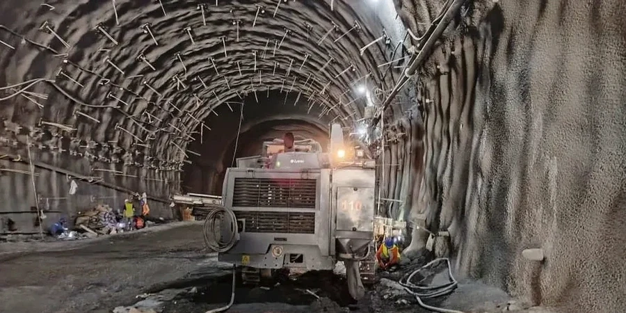
In St. Louis, the most critical phase of any deep foundation project often begins the moment the bucket hits the dirt. The city’s layered geology—a mix of stiff glacial till overlying Mississippian limestone—can lull contractors into a false sense of security until a limestone pinnacle or a void from the historic karst topography suddenly complicates the dig. We’ve seen excavation walls in the Central West End behave entirely differently than just a mile east near the riverfront, where the alluvial deposits are deeper and the groundwater table sits higher. Effective geotechnical excavation monitoring must capture these micro-local shifts before they translate into costly delays or structural damage. While a preliminary CPT test helps establish a baseline stratigraphy, the real value lies in the continuous interpretation of displacement data as the cut progresses. Our instrumentation program moves beyond simple inclinometer readings, integrating real-time piezometric data with automated total station surveys to provide a three-dimensional picture of ground response—a necessity when protecting 19th-century masonry buildings that line the streets of Soulard or Lafayette Square.
In St. Louis, the difference between a successful deep dig and a costly claim often hinges on recognizing the difference between a weathered limestone seam and a true solution cavity before the wall moves.
Process and scope
Local ground factors
The geotechnical risk profile shifts dramatically between North St. Louis County and the areas south of I-44. In northern parts, deep loess deposits—wind-blown silt dating back to the last glacial period—can stand vertically for years but collapse rapidly when saturated, creating a sudden loss of lateral support that standard monitoring programs often miss. Conversely, the karstic limestone south and west of the city, around Fenton and Sunset Hills, introduces the hazard of unmapped voids that can propagate to the surface as sinkholes during excavation dewatering. We address this disparity by coupling our standard deformation monitoring with a specific focus on groundwater chemistry, particularly in areas where historical lead smelting has altered soil pH, potentially accelerating corrosion of steel tiebacks. Without a rigorous excavation monitoring protocol, a contractor risks not only a wall failure but also triggering differential settlement in adjacent structures, which can lead to litigation that far exceeds the cost of the instrumentation program itself.
Reference standards
ASCE 7-22 Minimum Design Loads and Associated Criteria for Buildings and Other Structures, IBC 2024 Chapter 33 (Safeguards During Construction), ASTM D6230 Standard Guide for Monitoring Ground Movement Using Probe-Type Inclinometers, ASTM D7299 Standard Practice for Verifying Performance of Vertical Inclinometer Probes, OSHA 29 CFR 1926 Subpart P (Excavations)
Associated technical services
Continuous Automated Monitoring
We establish a secure network of in-place inclinometers, piezometers, and crack gauges linked to a remote server. The system generates a daily morning report and sends immediate SMS alerts if movement vectors approach 70% of the design threshold. This service includes weekly calibration checks against manual readings to comply with ASTM D7299.
Manual Survey & Instrumentation Oversight
For projects requiring a lower initial cost or where local ordinances require a registered engineer’s field notes, we deploy our technicians on a fixed schedule—typically bi-weekly during active excavation and monthly during the stabilization phase. We use a digital total station with a precision of 1 arc-second to track settlement monuments and wall targets, correlating the data with groundwater fluctuations recorded by standpipe piezometers.
Typical parameters
Questions and answers
What is the typical cost range for excavation monitoring on a commercial project in St. Louis?
For a standard 6-month program involving a single wall face up to 200 feet long, the cost generally falls between US$770 and US$2,720 per month, depending on whether you require automated real-time data or periodic manual surveys. The total investment is driven by the number of instruments, the depth of the excavation, and the vulnerability rating of the adjacent structures.
How do you distinguish between normal thermal movement and a real structural threat in the inclinometer data?
We apply a thermal correction algorithm to all inclinometer data, accounting for the coefficient of thermal expansion of the ABS casing. By comparing the temperature log with the deformation profile, we strip out diurnal thermal spikes. A real structural threat is identified by a persistent, progressive displacement trend that correlates with the excavation depth rather than ambient air temperature, and we verify this through a secondary survey method.
At what lateral displacement threshold do you typically recommend stopping work and installing additional bracing?
We do not use a universal number, because a 1-inch movement in a stiff clay till carries a different consequence than 0.5 inches in a loose fill behind a historic masonry bearing wall. We work with the design engineer to establish project-specific response levels: Advisory (50% of design capacity), Alert (70%), and Action (85%). The Action level triggers an immediate stop-work meeting and a review of the contingency bracing plan.